Stack the States® 2
- 4.6
- Rating
- 10.00K
- Installs
- $2.99
- Price
 Analysis by App-foxy
I found Stack the States® 2 most interesting when I stopped treating it as a simple geography quiz. It is an educational game built around recognizing US states, understanding where they belong, and making decisions under light game pressure. That combination gives it more practical value than a worksheet, while keeping the activity approachable for children and adults who want a relaxed way to refresh their knowledge.
My overall impression is positive, especially for families, teachers looking for a short geography activity, and learners who remember information better when they can interact with it. The experience is not equally comfortable for everyone, though. The game format may be more motivating than a textbook, but it also introduces timing, visual attention, and touch-control demands that some players may find tiring. I would recommend it most confidently as a flexible learning tool rather than as a complete geography course.
How the game presents geography and who benefits from it
Dan Russell-Pinson is the developer behind this educational title, which has earned a 4.6 average from over 400 ratings and has passed 10 thousand installs. Those figures suggest a small but established audience rather than a huge mainstream game community. It is priced at $2.99, carries an Everyone age rating, and runs on Android 5.1 or later. The current version is 2.3.
You May Also Like

 Blood Strike: 2.5 Anniversary
Blood Strike’s Loadouts Turn Every Drop Into a Tactical Gamble
A close look at Blood Strike’s custom loadouts: how fast access to signature weapons reshapes its battle royale rhythm, rewards preparation, and narrows the gap between fights.

 Pandora - Music & Podcasts
Pandora’s Music Is Easy to Start, but Harder to Recover
Pandora’s strength is its low-effort path from a seed to a station. Its weak spot is how much confidence it asks you to place in connection, setup, and quiet recovery.

 8 Ball Pool
 Is Built on Rivalries, Rematches, and Routine
A close look at the rivalries, rematches, shared routines, and unanswered safety questions that turn a quick pool match into a persistent mobile community.

 Samsung Music
’s Quiet Strength Is Playing What You Already Own
Its reach comes less from spectacle than from dependable access to a personal library. That simplicity is both the app’s strongest retention engine and its ceiling.

 AccuWeather: Weather Radar
AccuWeather Review: A Quick, Clear Forecast for Everyday Decisions
For everyday plans, the best forecast is the one you can understand quickly. AccuWeather makes rain timing, radar, and local conditions easy to act on, with a few trade-offs.

 Hill Climb Racing
Why Hill Climb Racing Still Turns Crashes Into One More Run
A tiny car, a bumpy hill and one more upgrade: Hill Climb Racing keeps resurfacing because its simple chaos makes every near-miss feel personal.
More From Our News Desk
View All News


That combination makes the game easy to place: it is aimed at general family use, not at advanced students preparing for a specialist exam. I can see it working particularly well for a child who knows state names but struggles to connect them with locations, or for a parent who wants something more active than asking flash-card questions. It can also suit an adult who wants to rebuild basic US geography knowledge without committing to a long study session.
The central appeal is the way knowledge is turned into a physical-looking task. Instead of only selecting an answer from a list, the player has to think about state identity and position while interacting with the game. That extra layer matters because it encourages recognition through context. I found that more memorable than repeatedly reading a list of capitals or looking at a static map.
Readability and navigation in ordinary use
The visual idea is easy to understand: geography is presented as something to manipulate rather than merely observe. For a new player, that can reduce the intimidation that sometimes comes with a blank map. You are not expected to begin with a perfect mental picture of the country. The game gives you an immediate task, and the task itself helps organize what you are learning.
I also think the straightforward educational framing helps younger players navigate without needing much explanation from an adult. A parent can sit beside a child and explain a state as it appears, turning a mistake into a small teaching moment. That is more useful than simply correcting an answer, because the player can connect the name with its shape or position while the information is still fresh.
There is a useful distinction between recognizing a state and recalling it independently. A game can make recognition feel successful before a learner can draw a map from memory. I would use that as a stepping stone, not as proof that the player has mastered every location. After a session, I would ask the child to name neighboring states or point them out on a separate map. That simple follow-up reveals whether the game knowledge is transferring beyond the immediate challenge.
For adults, the interface may feel more playful than necessary, but that is not automatically a weakness. I found the visual activity helpful when my attention was low. A conventional geography reference is better when I need to look up one precise fact, while this game is better when I want repeated practice without feeling as though I am studying.
One practical tip is to separate learning sessions from performance sessions. On the first attempt, let the player concentrate on identifying the state and noticing its location. On a later attempt, focus on speed or accuracy if the game encourages that style of play. Combining both goals immediately can make a learner rush through the visual information and remember less.
Motor and sensory considerations
The game’s interactive structure can be a strength for players who learn through touch and movement. Children who lose interest during verbal explanations may stay engaged when they can act on the map. The same quality can help a learner who benefits from doing something with information instead of only hearing or reading it.
At the same time, touch interaction is not neutral for every player. Someone with limited fine-motor control, hand fatigue, tremors, or difficulty making precise gestures may find a placement-based activity more demanding than a multiple-choice quiz. I would not assume that an Everyone rating means every child will find the controls equally accessible. The age label describes general content suitability, not individual physical or sensory comfort.
Visual attention is another consideration. Geography already requires the player to distinguish shapes, positions, and labels. If a child has reduced vision, color sensitivity, or difficulty separating small visual elements, the experience may require a larger screen and a quiet setting. I would test it personally before assigning it as independent work, then decide whether the player can identify the relevant information without constant help.
For a child who becomes overwhelmed by visual motion or game pressure, short turns are a sensible approach. I would keep the device stable, reduce surrounding distractions, and pause between attempts rather than pushing through frustration. Even without special equipment, those changes can make the activity less tiring. A parent can also read names aloud and discuss the location, allowing the game to become a shared activity instead of a test of solo screen performance.
Audio is not something I would make central to the learning plan. If a player cannot rely comfortably on sound, the adult should check that the important information can be understood visually during actual use. Conversely, if a player benefits from spoken prompts, I would treat any sound as supportive rather than as the only route to understanding. The safest approach is to observe how the individual responds instead of assuming that one presentation style works for everyone.
Situational access at home, in class, and on the move
A realistic use case would be a ten-minute after-school session. A child has finished homework but is not ready for a long lesson, so a parent opens the game and chooses a small goal: identify several states, talk about where they sit in relation to one another, and stop before attention drops. The parent does not need to turn the session into a lecture. A few questions such as “What is beside it?” or “Which part of the country is this?” can extend the value of each round.
In a classroom, I would use it as a station activity rather than as the only geography resource. One student can play while another uses a paper map to check locations, then they can compare what they noticed. This reduces the pressure on a learner who needs more time and gives the activity a social purpose. It also prevents the game from becoming a reward with no connection to the lesson.
The game is also suited to informal family learning because an adult can adjust the conversation around it. A younger player might focus on state names and broad regions. An older learner can discuss borders, neighboring states, or why a particular shape is easy to confuse with another. The same activity can therefore support different levels without pretending that all players are working toward the same outcome.
On a shared device, I would create a simple routine: one person plays, the other explains a choice, and then they switch. That approach is especially helpful for a learner who needs more time to process visual information. It also makes errors less embarrassing. The player is not left alone with a wrong answer; the mistake becomes a prompt for conversation.
For travel or waiting rooms, the game can fill a short gap more constructively than a general entertainment title. However, busy public spaces are not ideal for careful geography learning. Glare, movement, noise, and interruptions can make a visually demanding task frustrating. I would use it there for casual practice, not for introducing difficult material for the first time.
Because the game costs $2.99, the decision is relatively simple for someone specifically seeking an educational geography activity, but I would still consider how often it will be used. A family that already has maps, books, and geography games may prefer a free resource for occasional review. Someone who wants a reusable interactive activity may find the one-time purchase easier to justify than repeatedly buying printed materials, especially if several family members share the sessions.
What it does better than usual alternatives
Compared with a paper map, the game offers more immediate interaction and a clearer sense of progress. Paper is still better for drawing, writing notes, and seeing the whole country at once. I would use the paper map after playing, because it exposes whether the player understands the larger layout rather than only the individual task presented on screen.
Compared with flash cards, this title gives location more importance. Flash cards are excellent for quick recall of names, capitals, or abbreviations, but they can leave a learner with isolated facts. The game’s spatial focus helps connect a state with its place. The trade-off is that flash cards are easier to adapt for a learner who needs larger print, slower pacing, or a completely non-visual approach.
Compared with a general map app, this is more structured and more playful. A map app is better for exploring freely, zooming into regions, or answering a specific real-world question. This game is better when the learner needs a reason to keep practicing. I would choose the map app for curiosity-led exploration and this title for guided repetition.
Compared with a classroom worksheet, the game can make repetition less monotonous. The drawback is that a worksheet makes it easier for a teacher to see exactly what a student knows and to customize the task. The strongest combination is not choosing one permanently: use the game to build interest, then use a map or written activity to check independent understanding.
Remaining barriers and situations where I would skip it
The first barrier is that game motivation does not work for every learner. Some children enjoy collecting progress and responding to challenges, while others become anxious when an activity feels like a test. If a player starts guessing rapidly, avoids the screen, or becomes upset after mistakes, I would switch to a calm map discussion rather than insisting on another round.
The second is the difference between familiarity and mastery. A player may become good at recognizing the visual prompt inside the game without being able to locate the state later on an unlabeled map. That is not a flaw in the concept, but it is an important limit. I would always pair repeated play with occasional recall away from the app.
The third is physical access. If precise touch interaction is uncomfortable, a traditional quiz with larger selectable answers, spoken instruction, or paper materials may be a better primary tool. I would not recommend buying this specifically to solve an accessibility need unless the intended player has tried the interaction and found it manageable.
I would also skip it for someone seeking detailed US geography. The game is a focused learning experience, not a replacement for a reference guide covering state history, population, climate, landmarks, or regional culture. An older student preparing for a formal assessment may need a resource organized around the exact syllabus instead.
Finally, supervision can matter for younger children. The Everyone rating makes it suitable for a broad audience, but it does not remove the need for an adult to judge whether the pace, visual presentation, and level of challenge fit a particular child. A short trial session tells me more than the age label alone.
My inclusive verdict
I recommend Stack the States® 2 to families and educators who want an inviting way to practice US geography through interaction. Its best quality is the bridge it creates between naming a state and understanding where it belongs. It can support learners who need a more active alternative to reading, and it works especially well when an adult turns each round into a brief conversation.
I would approach it as one part of a broader learning routine. Use a large, clear screen, keep sessions short, allow extra time, and follow play with an unlabeled map or a spoken question. Those habits make the experience more inclusive without claiming that the game itself solves every access need.
For players who enjoy game-like practice, the $2.99 price is reasonable, and the 4.6 average indicates that many users have responded well to it. For learners who need extensive customization, very slow pacing, non-visual instruction, or advanced geography content, a different tool may be the better choice. My final view is that this is a focused, friendly geography game with real educational value, provided its interactive demands match the person using it.
FAQs for Stack the States® 2
01What is Stack the States® 2, and how is it played?
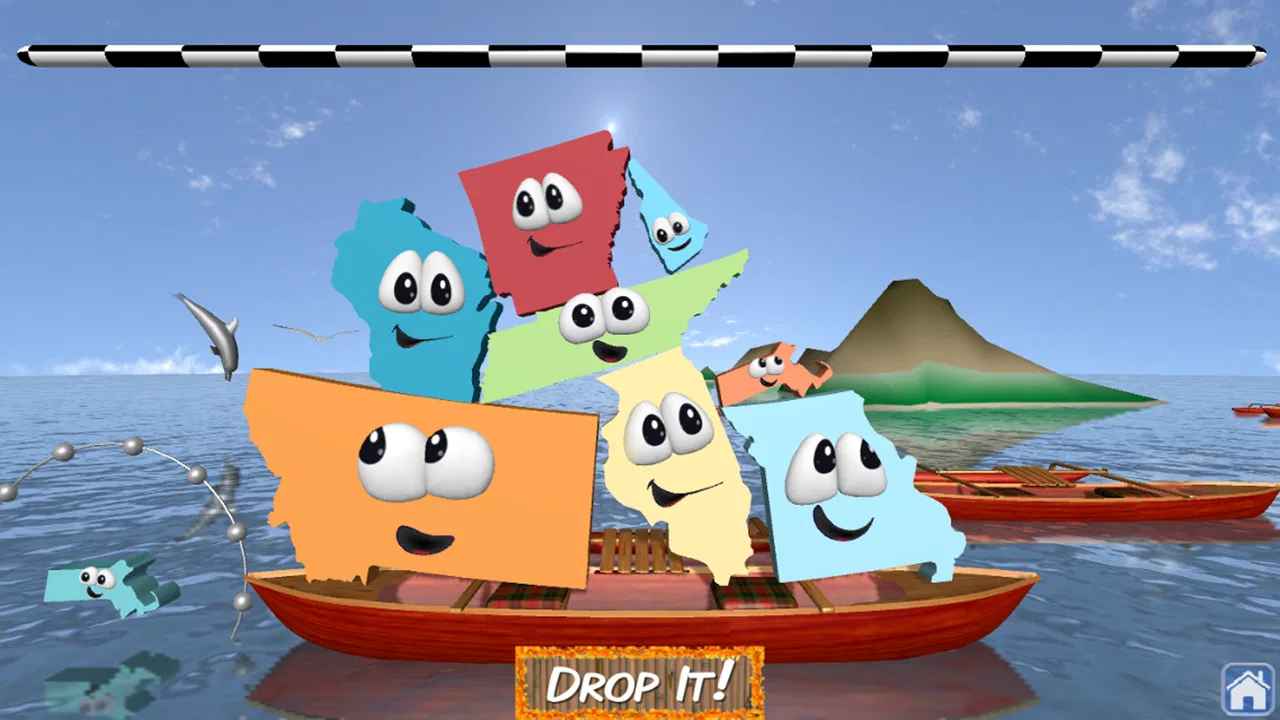
Stack the States® 2 is an educational geography game that helps players learn about the United States through interactive questions and physics-based challenges. You answer questions about states, capitals, landmarks, flags, abbreviations, and geography. Correct answers let you drop and stack state-shaped pieces, while completing objectives unlocks additional content and keeps the experience more engaging than a traditional quiz.
02Is Stack the States® 2 suitable for children and students?
Yes, the game is primarily designed for children, students, families, and anyone who wants to review U.S. geography in a playful way. The questions are generally accessible to elementary and middle-school learners, although difficulty can vary depending on the topic. Parents and teachers may find it useful as a supplementary learning tool rather than a complete replacement for classroom instruction.
03Does Stack the States® 2 require an internet connection?
The main gameplay experience can generally be enjoyed without a constant internet connection once the application is installed. This makes it convenient for travel, classrooms, or situations where Wi-Fi and mobile data are unavailable. However, certain functions, such as downloading updates, accessing store-related features, or using platform services, may require connectivity depending on the device and operating system.
04Is Stack the States® 2 free to download or does it include purchases?
Availability and pricing may differ between the Apple App Store and Google Play, as well as by country and device. Before downloading, check the official store listing for the current price, supported platforms, and any in-app purchase information. Some versions of educational games may include optional purchases, advertisements, or additional content, so reviewing the listing is recommended before installation.
05What devices are compatible with Stack the States® 2?
Compatibility depends on the version available for your operating system and the requirements listed by the official store. The game is intended for supported Android and iOS devices, but older phones or tablets may not run it properly or may provide a less comfortable experience. Check the app page for the minimum operating-system version, required storage, and recent compatibility notes before downloading.
Pros
- Engaging map-based gameplay makes learning U.S. geography feel interactive.
- Covers capitals
- landmarks
- regions
- and state facts in varied activities.
- Progress tracking helps children see which topics they have mastered.
- Bright visuals and animations keep younger learners interested.
- Works well for short practice sessions at home or in the classroom.
Cons
- The content is focused entirely on the United States.
- Some questions may feel repetitive after extended play.
- Younger children may need help reading instructions and facts.
- The game offers limited depth for advanced geography students.
- The one-time purchase may feel expensive for occasional use.

Stack the States® 2
Gallery